Northwest Drone Service is a top-tier drone service and data solutions company based in Northern Idaho. With over a decade of experience in post-production and marketing and a passion for aviation, we bring a unique and highly skilled perspective to each project. Northwest Drone Service has provided mapping and imagery services to a myriad of customers including production companies, land owners, event planners, commercial real estate brokers, construction superintendents, action sport enthusiasts and more. Whether you're looking for stunning aerial footage, comprehensive data analysis, or a combination of the two, Northwest Drone Service has the expertise and resources to bring your project to new heights.
Request Demo
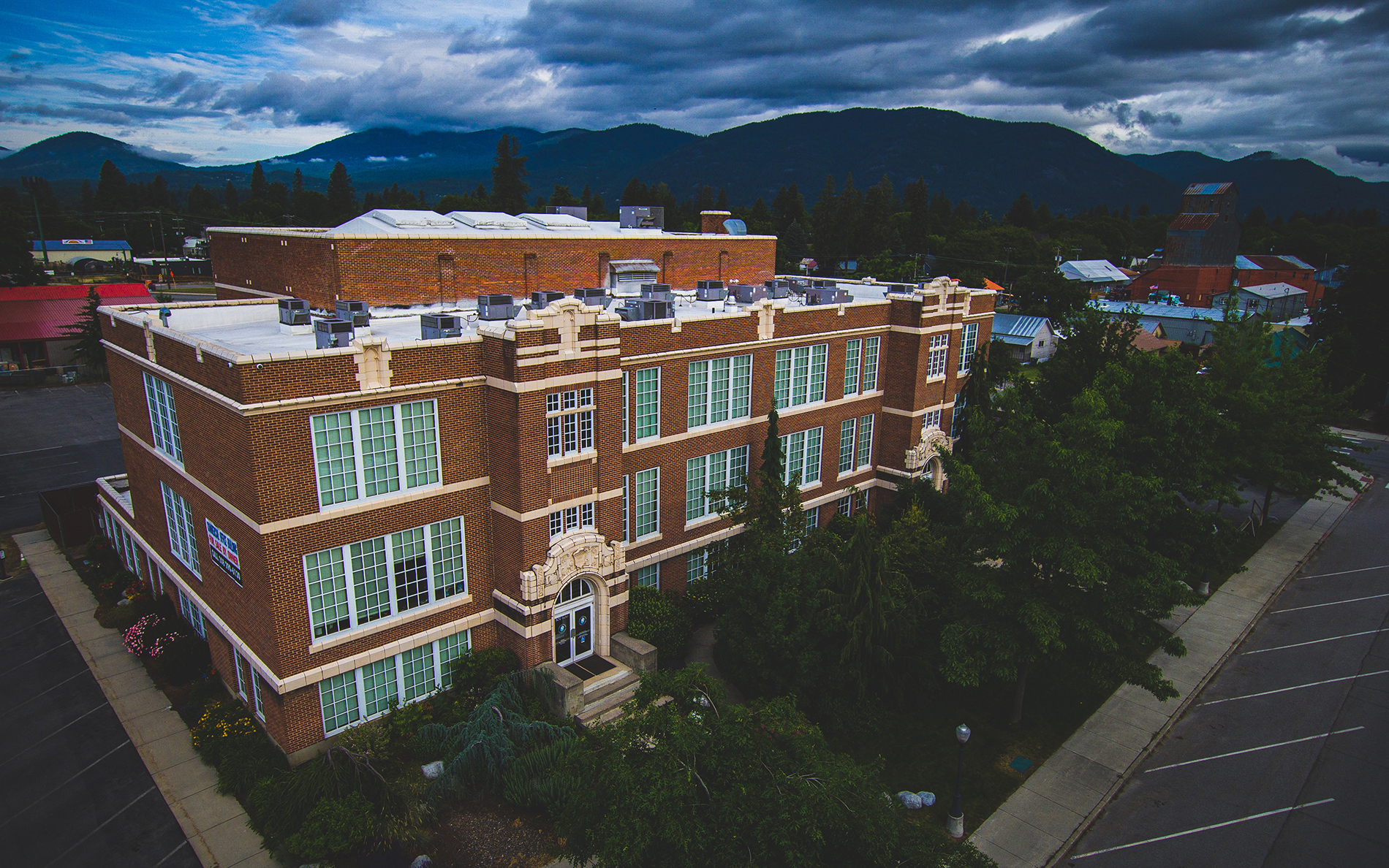
We deliver projects of the highest quality, ultimately ensuring that your stakeholders receive the critical insights needed to drive successful outcomes in their respective fields. Drone maps and models can help you share highly-visual information and real-time updates with teams, stay on budget and finish projects on-time. Our maps and models allow you to easily monitor site progress, spot for mistakes or deviations from plans and measure stockpiles. This is an indispensable and cost-effective tool for the construction industry.
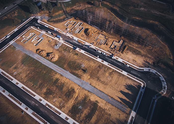
Northwest Drone Service transforms aerial imagery into high-resolution maps, essential in an array of industries including agriculture, construction, real estate and insurance. Orthomosaic photogrammetry is at the forefront of a mapping revolution and we have the ability to produce topographically-accurate maps very quickly compared to traditional survey methods.
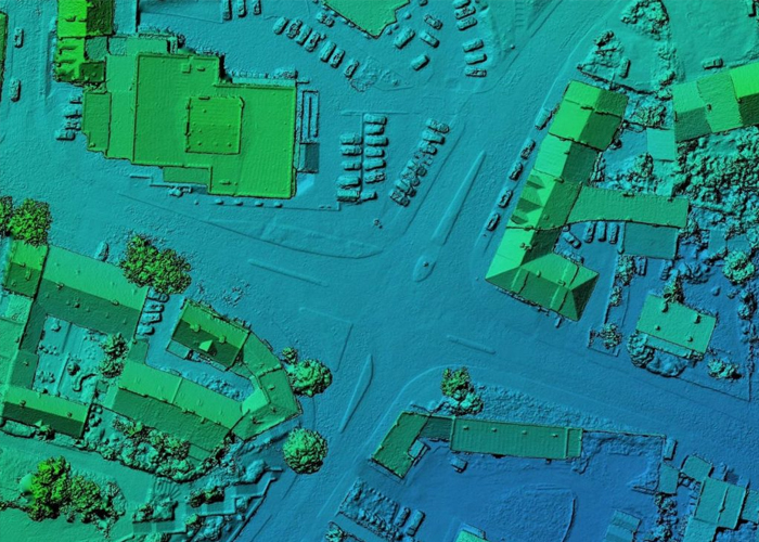
Our DSM's provide accurate representations of the Earth's terrain and above-ground features. This grants you the ability to quickly assess land topography, calculate cut and fill volumes, plan infrastructure projects, identify flood-prone areas, and optimize agricultural practices. Gain powerful, data-driven insights to improve project efficiency while minimizing risks.
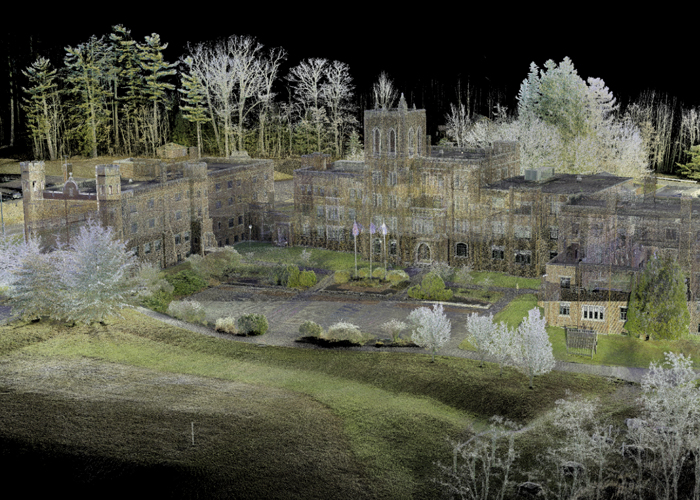
Using advanced photogrammetry techniques we are able to stitch data into accurate 3D models, letting you visualize and analyze terrain, buildings and other structures in the environment with unprecedented detail. Our 3D mapping drones empower our clients with actionable insights, reducing costs, enhancing decision-making and ultimately improving the quality and efficiency of their projects.
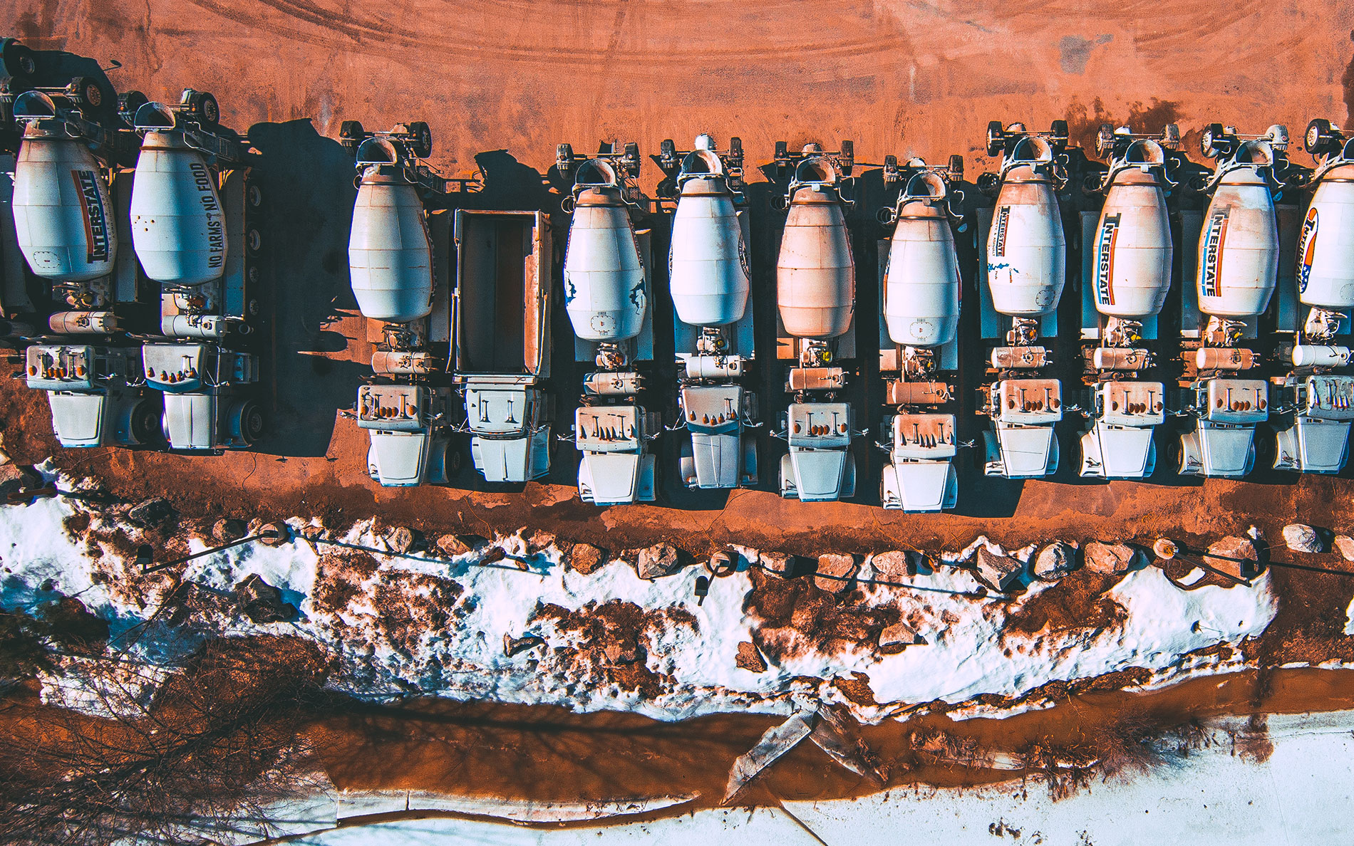
Northwest Drone Service makes capturing photos and videos from the air unique and exciting. Make memories last forever, supercharge marketing materials, sell homes faster, book more rentals or engage your online audience with our custom drone content and indoor fly-through tours. Elevate your brand with breathtaking aerial photography and video.
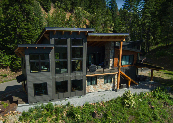
Our custom drone content can compliment your existing marketing campaigns or lead them out front with unique perspectives unmatched from the ground. One great way to increase your brand recognition and engage your audience is by releasing original content. We create advertisements for the web, including content for platforms like YouTube and Instagram.
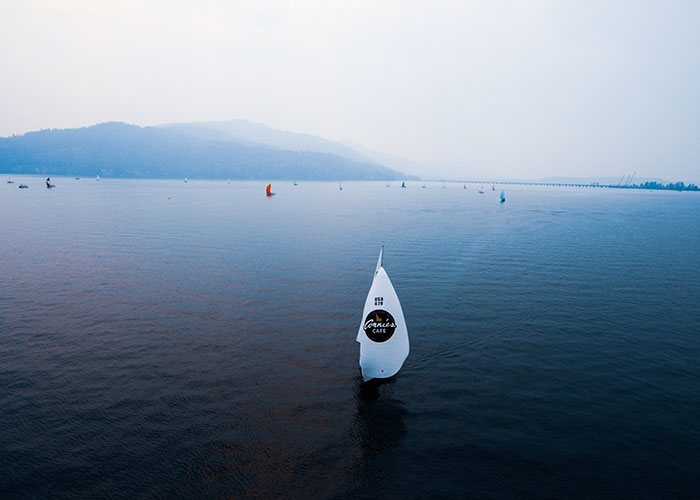
Drones are becoming increasingly popular for private events like weddings, parties, and corporate gatherings. Our drones will provide stunning views of your event, capturing memories that last a lifetime. Our drone services bring a new level of excitement to private events, offering a one-of-a-kind perspective and delivering projects of the highest quality.
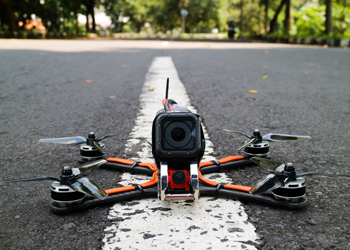
Thrilling and immersive - Our FPV drones are small enough to fit though doorways, car windows and other tight spaces, making them perfect for filming indoors and near people, while larger, faster drone configurations can capture high-speed footage at up to 100MPH, getting up-close to the action at race events and fireworks displays.
Aerial imaging has revolutionized the way we capture stunning views, monitor large areas, and document landscapes. Drones are the future of aerial photography and videography, offering several advantages over traditional methods like helicopters or manned aircraft. Here’s why drones are the smarter, more efficient choice for aerial imaging:
1. Cost-Effective - Drones are significantly more affordable than hiring a helicopter or plane for aerial shots. With no need for costly fuel, pilot fees, or permits required for manned aircraft, drones provide high-quality aerial imagery at a fraction of the cost. This makes them an accessible option for businesses and individuals looking to capture breathtaking views without breaking the bank.
2. High-Quality Imaging - Drones are equipped with advanced cameras capable of capturing ultra-high-definition photos and videos. From 4K resolution to 360-degree views, drones can capture sharp, detailed imagery that provides superior results for everything from real estate photography to cinematic shots. Drones also offer stability features, ensuring smooth, clear images even in windy conditions.
3. Versatility & Flexibility - Drones are incredibly versatile and can access locations that would otherwise be difficult or impossible to reach. Whether you're shooting from a low altitude over a dense forest or soaring above a busy city, drones can maneuver around obstacles and fly in tight spaces. They can also be used for both stills and video, offering complete flexibility for your creative or professional needs.
4. Quick Setup and Mobility - Compared to the lengthy process of organizing a manned aircraft, drones are quick to deploy and easy to transport. They can be set up within minutes and are highly mobile, making them ideal for capturing time-sensitive events or projects. Their compact design also allows for aerial shots in locations that traditional aircraft can’t access.
5. Safety - Drones operate at much lower altitudes and speeds than manned aircraft, meaning there’s less risk to both the drone operator and the general public. Additionally, drones are equipped with various safety features, such as GPS tracking, automatic return-to-home functions, and obstacle avoidance sensors, making them safe to use even in challenging environments.
6. Environmental Impact - Drones are a more eco-friendly alternative to helicopters and planes, which consume large amounts of fuel. Drones are typically battery-powered, making them a greener choice for capturing aerial imagery while reducing your environmental footprint.
7. Real-Time Monitoring - Drones allow for live video streaming to the operator on the ground, making it possible to monitor and adjust shots in real-time. This provides flexibility during shoots and ensures the perfect shot every time. Whether for filming a live event, surveying land, or documenting progress on a construction site, drones offer immediate results.
8. Accurate Data Collection - Drones are not only useful for capturing images and videos but also for collecting valuable data. Equipped with sensors and GPS, drones can gather precise geographical data for mapping, surveying, and land analysis, providing professionals with high-quality aerial data for projects in agriculture, construction, and more.
Conclusion - Drones provide unparalleled advantages in terms of cost, flexibility, safety, and image quality. Whether you're looking to capture breathtaking images for a marketing campaign, survey land for development, or explore new creative avenues, drones are the modern, efficient solution for all your aerial imaging needs.
Get in touch with us today to discuss your drone service needs. Whether you're working on a large production or a small personal project, we’re here to provide top-tier drone services that take your vision to new heights.